
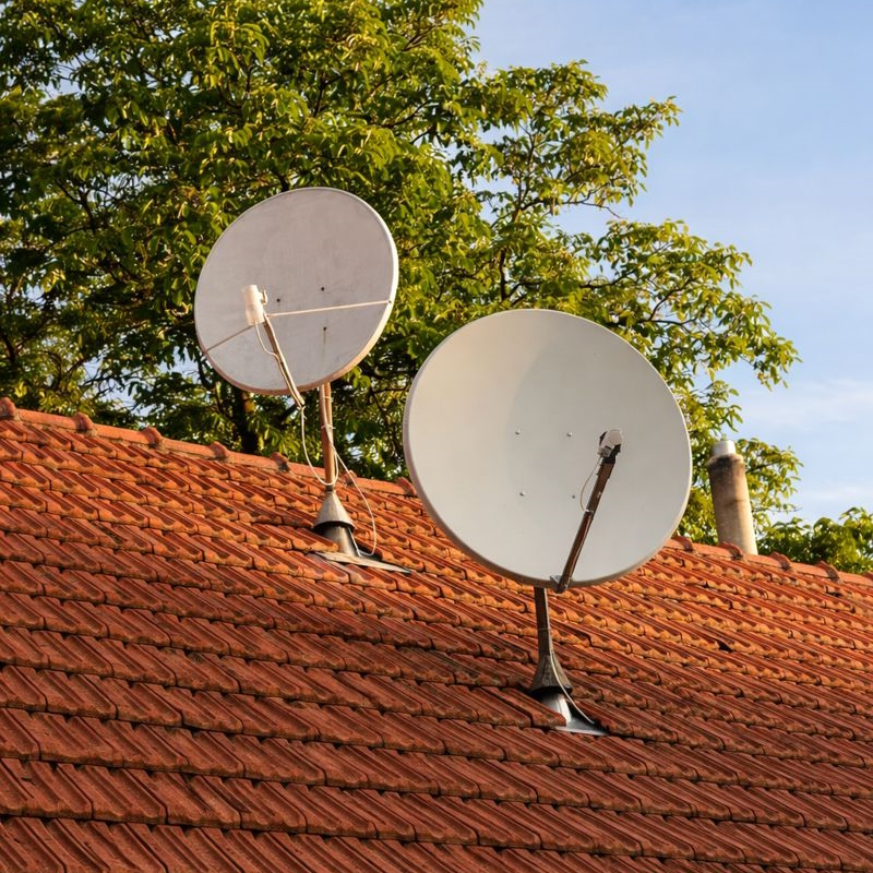
SATELLITE DISH
Align your satellite dish quickly and accurately with precise calculations for azimuth, elevation, and LNB skew based on your location.
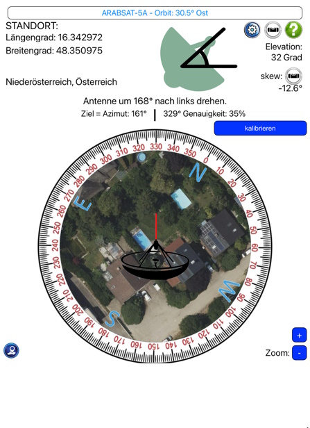
App Screenshots
Key Features
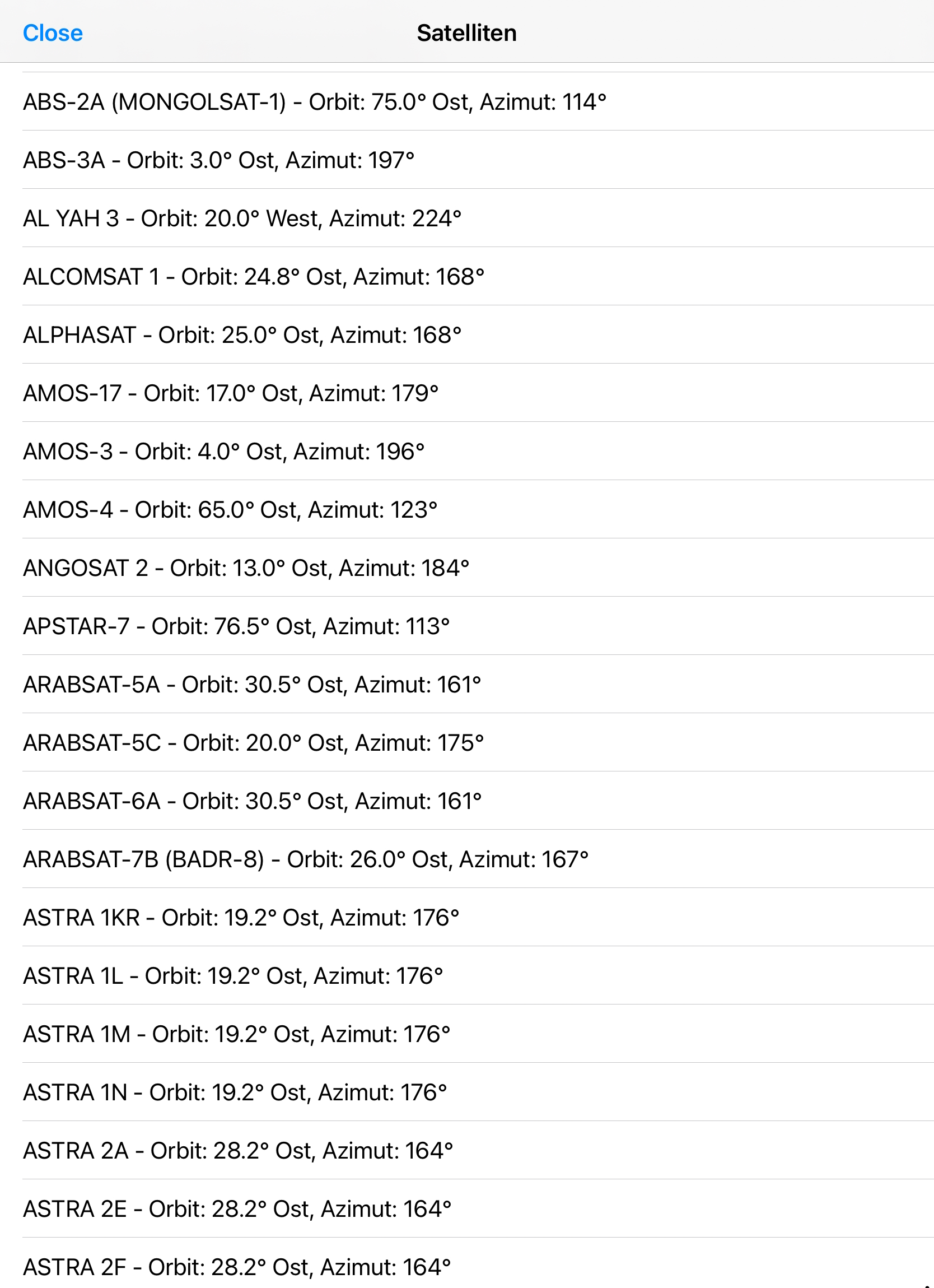
- Supports all common TV satellites such as Astra, Hotbird, Eutelsat and more
- Precise calculation of azimuth, elevation and LNB skew
- Location detection via GPS or manual input
- Compass and map view for optimal alignment
- Ideal for new installations and fine tuning
- Worldwide usage
- No registration required
- Clean and easy-to-use interface
FAQ
Is the app free?
Yes. The app is free.
Which satellites are supported?
All common TV satellites worldwide are supported, including Astra and Hotbird.
Do I need internet?
Internet is only required for the map view. All calculations also work offline.
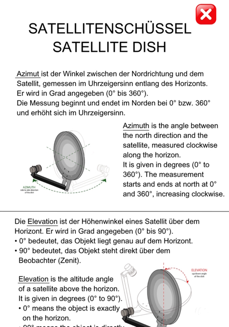
What is azimuth?
Azimuth is the angle between the north direction and the satellite, measured clockwise along the horizon. It is given in degrees (0° to 360°). The measurement starts and ends at north at 0° and 360° and increases clockwise.
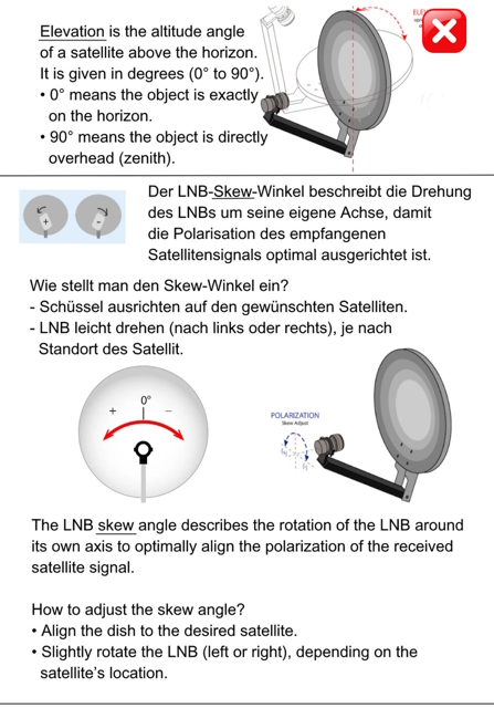
What is elevation?
Elevation is the vertical angle of a satellite above the horizon. It is given in degrees (0° to 90°). 0° means the object is exactly on the horizon. 90° means the object is directly above the observer (zenith).
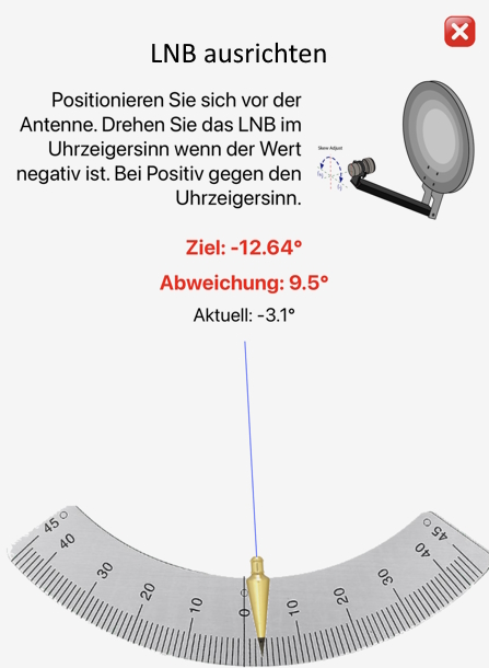
What is the LNB skew angle?
The LNB skew angle describes the rotation of the LNB around its own axis to optimally align the polarization of the received satellite signal.
How do you adjust the skew angle?
Align the satellite dish to the desired satellite. Then slightly rotate the LNB (left or right), depending on the satellite position.